Maps
The ChartFactor Toolkit has two types of maps:
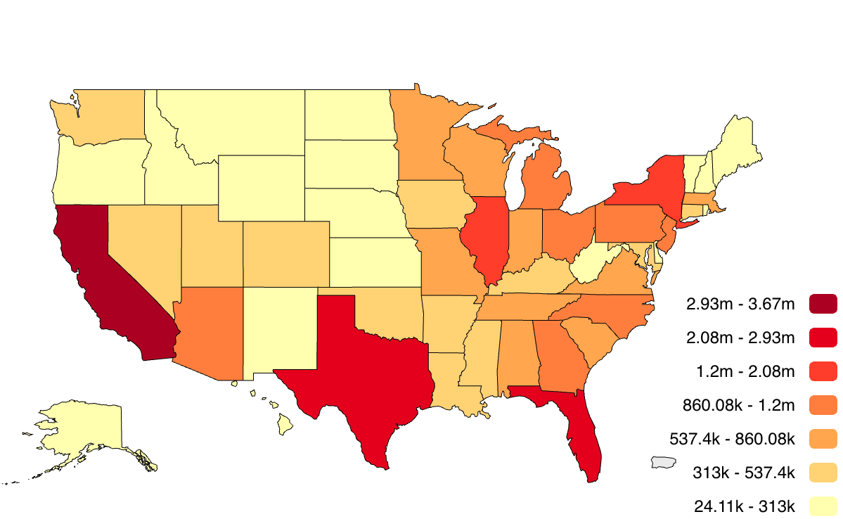
- Vector Maps are good for representing fixed regional information such as metrics about countries, provinces, etc. and is provided in the standard visualizations package.
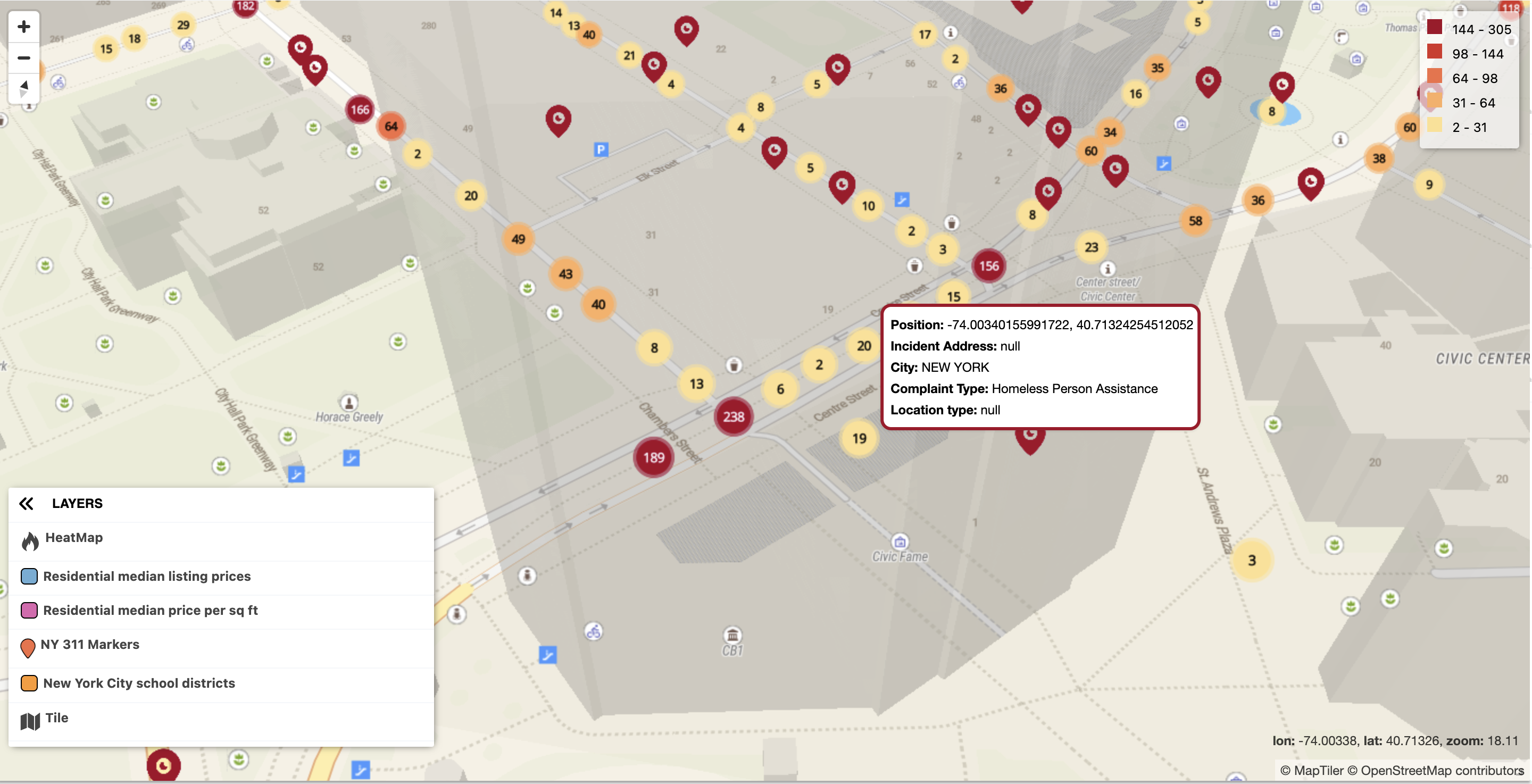
- Geo Maps are good at representing information with high geospatial precision such as points and polygons. It makes use of custom markers, shapes, and proportional circles between others. Geo Maps are provided in the geo visualization package.
Please refer to the Vector Map and the Geo Map GL documentation for their detailed information.